Kaba Kama
| Kaba Kama | ||
|---|---|---|
| Koordinaten: 13° 18′ N, 14° 12′ W | ||
| Region: | Upper River | |
| Distrikt: | Fulladu East | |
| Einwohner: | 2383 (2013)
| |
| <timeline>
ImageSize = width:240 height:140 PlotArea = left:50 bottom:20 width:190 height:120 TimeAxis = orientation:horizontal AlignBars = early Colors = id:hellgrau value:gray(0.9) id:graygrid value:gray(0.5) id:farbe value:drabgreen DateFormat = yyyy Period = from:1961 till:2028 ScaleMajor = unit:year increment:15 start:1965
 bar:15 text:""


 bar:5 text:2500
 bar:4 text:2000
 bar:3 text:1500
 bar:2 text:1000
 bar:1 text:500
PlotData = color:hellgrau width:0.1 Bar:15 from:start till:end Bar:5 from:start till:end Bar:4 from:start till:end Bar:3 from:start till:end Bar:2 from:start till:end Bar:1 from:start till:end LineData = layer:front frompos:21 color:farbe width:1 at:1993 tillpos:95.48 at:2010 tillpos:119.56 at:2012 tillpos:121.2 at:2013 tillpos:116.32 TextData = pos:(0,28) tabs:(46-right) text:"^0" pos:(0,140) tabs:(50-right) text:"^Einwohner" </timeline> | ||
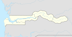
Kaba Kama (Schreibvarianten: Kaba Kamma und Kabakama) ist eine Ortschaft im westafrikanischen Staat Gambia.
Nach einer Berechnung für das Jahr 2013 leben dort etwa 2383 Einwohner, das Ergebnis der letzten veröffentlichten Volkszählung von 1993 betrug 1862.[1]
Geographie
Kaba Kama liegt in der Upper River Region (URR) Distrikt Fulladu East und liegt benachbart östlich an Basse Santa Su an der South Bank Road. Zwei Brücken die Kaba Kama mit Basse verbinden wurden 2011 erneuert.[2]
Siehe auch
Einzelnachweise
- ↑ Kaba Kama auf bevoelkerungsstatistik.de (online nicht mehr erreichbar, letzter Zugriff Mai 2013)
- ↑ Basse-Kaba Kama bridges undergo reconstruction (Memento vom 31. Oktober 2013 im Internet Archive). The Daily Observer vom 9. Juli 2011.
