Bourem
aus Wikipedia, der freien Enzyklopädie
| Bourem | ||
|---|---|---|
|
| ||
| Koordinaten | 16° 57′ N, 0° 21′ W | |
| Basisdaten | ||
| Staat | Mali | |
| Gao | ||
| Kreis | Gao | |
| ISO 3166-2 | ML-7 | |
| Fläche | 6294 km² | |
| Einwohner | 27.486 (2009) | |
| Dichte | 4,4 Ew./km² | |
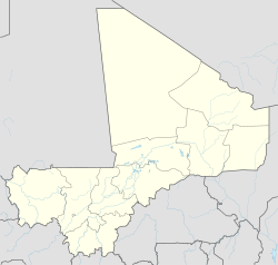
Bourem ist eine kleine Stadt im Nordosten von Mali. Bourem liegt am Nordufer des Niger an der Tanezrouftpiste.
Einwohnerentwicklung
| Grafik Einwohnerentwicklung
<timeline> Colors= id:lightgrey value:gray(0.9) id:darkgrey value:gray(0.7) id:sfondo value:rgb(1,1,1) id:barra value:rgb(0.6,0.7,0.8) ImageSize = width:250 height:333 PlotArea = left:50 bottom:50 top:30 right:30 DateFormat = x.y Period = from:0 till:30000 TimeAxis = orientation:vertical AlignBars = justify ScaleMajor = gridcolor:darkgrey increment:5000 start:0 ScaleMinor = gridcolor:lightgrey increment:1000 start:0 BackgroundColors = canvas:sfondo BarData= bar:1976 text:1976 bar:1987 text:1987 bar:1998 text:1998 bar:2009 text:2009 PlotData= color:barra width:25 align:center bar:1976 from:0 till: 4538 bar:1987 from:0 till: 5609 bar:1998 from:0 till: 21227 bar:2009 from:0 till: 27486 PlotData= bar:1976 at: 4538 fontsize:S text: 4.538 fontsize:M shift:(2,5) bar:1987 at: 5609 fontsize:S text: 5.609 fontsize:M shift:(2,5) bar:1998 at: 21227 fontsize:S text: 21.227 fontsize:M shift:(2,5) bar:2009 at: 27486 fontsize:S text: 27.486 fontsize:M shift:(2,5) TextData= fontsize:S pos:(20,20) text:"Einwohner auf dem Gebiet der Stadt Bourem" </timeline> |
