Datei:Cape canaveral.jpg

Originaldatei (5.320 × 5.266 Pixel, Dateigröße: 7,79 MB, MIME-Typ: image/jpeg)
![]()
Diese Datei und die Informationen unter dem roten Trennstrich werden aus dem zentralen Medienarchiv Wikimedia Commons eingebunden.
Beschreibung
| BeschreibungCape canaveral.jpg |
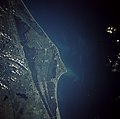
English: Cape Canaveral, Florida and the NASA John F. Kennedy Space Center are shown in this near-vertical photograph. Numerous launch pads line the Atlantic Ocean coast near the center of the photograph. To the north of the multiple launch pads, the Space Shuttle landing runway, the Shuttle Assembly Area, and Shuttle Launch Pads A and B are visible. To the south of the multiple launch pads are Port Canaveral and the city of Cocoa Beach, Florida. To the west of the space complex, five causeways span the Indian and Banana Rivers. Interstate Highway 95 is the main artery traversing south to north just west of the Florida cities of Cocoa and Titusville. |
|||
| Datum | ||||
| Quelle | Gateway to Astronaut Photography of Earth (image link) | |||
| Urheber | NASA | |||
| Genehmigung (Weiternutzung dieser Datei) |
|
|||
| Andere Versionen |
Cape canaveral crop.jpg: |
| Objektposition | 28° 30′ 00″ N, 80° 30′ 00″ W | Dieses und weitere Bilder auf OpenStreetMap |
|---|
| Kameraposition | 28° 18′ 00″ N, 79° 18′ 00″ W | Dieses und weitere Bilder auf OpenStreetMap |
|---|
Diese Mediendatei wurde vom Johnson Space Center der US-amerikanischen National Aeronautics and Space Administration (NASA) unter der Datei-ID STS043-084-031 kategorisiert. Diese Markierung zeigt nicht den Urheberrechtsstatus des zugehörigen Werks an. Es ist in jedem Falle zusätzlich eine normale Lizenzvorlage erforderlich. Siehe Commons:Lizenzen für weitere Informationen. Sprachen:
العربية ∙ беларуская (тарашкевіца) ∙ български ∙ català ∙ čeština ∙ dansk ∙ Deutsch ∙ English ∙ español ∙ فارسی ∙ français ∙ galego ∙ magyar ∙ հայերեն ∙ Bahasa Indonesia ∙ italiano ∙ 日本語 ∙ македонски ∙ മലയാളം ∙ Nederlands ∙ polski ∙ português ∙ русский ∙ sicilianu ∙ slovenščina ∙ Türkçe ∙ українська ∙ 简体中文 ∙ 繁體中文 ∙ +/− |
|
Dieses Bild zeigt ein Objekt, das im National Register of Historic Places der Vereinigten Staaten verzeichnet ist. Die Referenznummer lautet 84003872. |
| Bildnotizen InfoField | Diese Datei ist annotiert: Betrachte diese auf Commons. |
Launch Complex 39A, used for Saturn V, the Space Shuttle, Falcon 9, and Falcon Heavy launches.
Launch Complex 39B, used for Saturn V, the Space Shuttle, and Ares I-X launches.
Kennedy Space Center industrial area
Space Launch Complex 41, used for Titan III, Titan IIIE, Titan IV, and Atlas V launches.
Space Launch Complex 40, used for Titan III, Titan IV, and Falcon 9 launches.
Space Launch Complex 37, used for Saturn I, Saturn IB, and Delta IV launches.
Launch Complex 26, the launch site for Explorer 1, the first American successful satellite.
Launch Complexes 10, 31, and 32. LC-31 was used as a burial vault for the remains of the Space Shuttle Challenger.
The "Missile Row", used for Atlas and Titan launches and Falcon 9 landings.
Landing Zones 1 and 2 (formerly Launch Complex 13), used for Atlas launches and Falcon 9 landings.
Kurzbeschreibungen
In dieser Datei abgebildete Objekte
Motiv
7. August 1991
28°18'N, 79°18'W
28°30'N, 80°30'W
STS043-084-031
image/jpeg
b728acc4b15c6938a58eb3f9ade879448135b8a9
8.163.743 Byte
5.266 Pixel
5.320 Pixel
Dateiversionen
Klicke auf einen Zeitpunkt, um diese Version zu laden.
| Version vom | Vorschaubild | Maße | Benutzer | Kommentar | |
|---|---|---|---|---|---|
| aktuell | 19:35, 21. Mär. 2009 |  | 5.320 × 5.266 (7,79 MB) | wikimediacommons>Jhf | Same image with greater resolution |
Dateiverwendung
Die folgenden 3 Seiten verwenden diese Datei:
Metadaten
Diese Datei enthält weitere Informationen (beispielsweise Exif-Metadaten), die in der Regel von der Digitalkamera oder dem verwendeten Scanner stammen. Durch nachträgliche Bearbeitung der Originaldatei können einige Details verändert worden sein.
| _error | 0 |
|---|