Datei:Cotswolds AONB locator map.svg
aus Wikipedia, der freien Enzyklopädie

Größe der PNG-Vorschau dieser SVG-Datei: 494 × 600 Pixel. Weitere Auflösungen: 198 × 240 Pixel | 395 × 480 Pixel | 633 × 768 Pixel | 844 × 1.024 Pixel | 1.687 × 2.048 Pixel | 1.648 × 2.000 Pixel.
Originaldatei (SVG-Datei, Basisgröße: 1.648 × 2.000 Pixel, Dateigröße: 1,08 MB)
![]()
Diese Datei und die Informationen unter dem roten Trennstrich werden aus dem zentralen Medienarchiv Wikimedia Commons eingebunden.
![]()
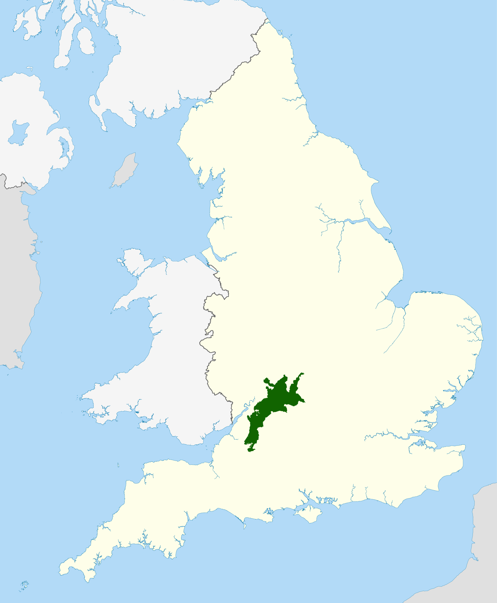
| Beschreibung |
Locator map of the Cotswolds range of hills in central and western England.
|
| Datum | |
| Quelle |
National Geospatial-Intelligence Agency
|
| Urheber | Nilfanion, using Ordnance Survey and Natural England data |
| Genehmigung (Weiternutzung dieser Datei) |
Diese Datei ist unter der Creative-Commons-Lizenz „Namensnennung – Weitergabe unter gleichen Bedingungen 3.0 nicht portiert“ lizenziert. Namensnennung: © Natural England copyright 2012. Contains Ordnance Survey data © Crown copyright and database right 2012
|
Dateiversionen
Klicke auf einen Zeitpunkt, um diese Version zu laden.
| Version vom | Vorschaubild | Maße | Benutzer | Kommentar | |
|---|---|---|---|---|---|
| aktuell | 22:15, 15. Apr. 2012 | | 1.648 × 2.000 (1,08 MB) | wikimediacommons>Nilfanion | {{Information |Description=Locator map of the Cotswolds Area of Outstanding Natural Beauty within England |Source=Ordnance Survey [https://www.ordnancesurvey.co.uk/opendatad... |
Dateiverwendung
Die folgende Seite verwendet diese Datei:
