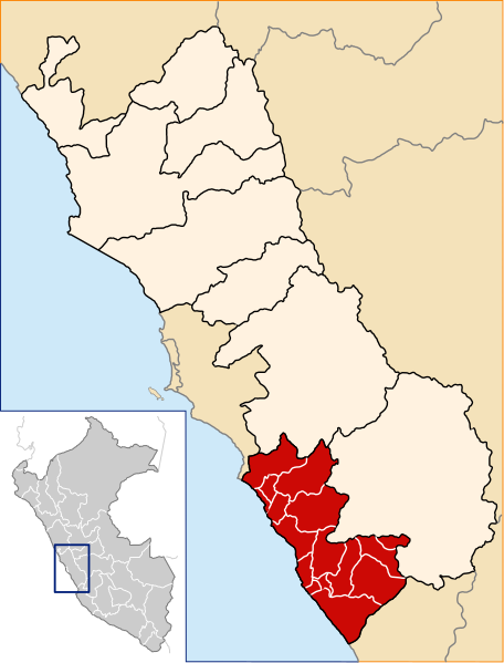
Datei:Location of the province Cañete in Lima.svg
aus Wikipedia, der freien Enzyklopädie

Größe der PNG-Vorschau dieser SVG-Datei: 456 × 599 Pixel. Weitere Auflösungen: 183 × 240 Pixel | 365 × 480 Pixel | 585 × 768 Pixel | 779 × 1.024 Pixel | 1.559 × 2.048 Pixel | 491 × 645 Pixel.
Originaldatei (SVG-Datei, Basisgröße: 491 × 645 Pixel, Dateigröße: 371 KB)
Dateiversionen
Klicke auf einen Zeitpunkt, um diese Version zu laden.
| Version vom | Vorschaubild | Maße | Benutzer | Kommentar | |
|---|---|---|---|---|---|
| aktuell | 19:17, 20. Dez. 2007 |  | 491 × 645 (371 KB) | wikimediacommons>AgainErick | == Summary == {{Information |Description=Location of the province Cañete in the Lima region in Peru (Map) |Source=own work |Date=december 20, 2007 |Author=Eric Bronder |Permission=GFDL |other_versions= }} [[Category:Locator maps of |
Dateiverwendung
Die folgenden 17 Seiten verwenden diese Datei:
- Distrikt Asia
- Distrikt Calango
- Distrikt Cerro Azul
- Distrikt Chilca (Cañete)
- Distrikt Coayllo
- Distrikt Imperial
- Distrikt Lunahuaná
- Distrikt Mala
- Distrikt Nuevo Imperial
- Distrikt Pacarán
- Distrikt Quilmaná
- Distrikt San Antonio (Cañete)
- Distrikt San Luis (Cañete)
- Distrikt San Vicente de Cañete
- Distrikt Santa Cruz de Flores
- Distrikt Zúñiga
- Provinz Cañete
