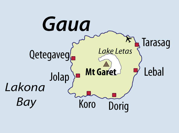
Datei:Map-Gaua-Vanuatu.png
aus Wikipedia, der freien Enzyklopädie
Map-Gaua-Vanuatu.png (727 × 544 Pixel, Dateigröße: 37 KB, MIME-Typ: image/png)
Dateiversionen
Klicke auf einen Zeitpunkt, um diese Version zu laden.
| Version vom | Vorschaubild | Maße | Benutzer | Kommentar | |
|---|---|---|---|---|---|
| aktuell | 08:33, 23. Nov. 2010 |  | 727 × 544 (37 KB) | wikimediacommons>Womtelo | {{Information |Description={{en|1=I have drawn this map of the Torres Islands (Vanuatu) based on several other maps showing sufficient precision. I paid special attention to the transcription of place names, based on personal fieldwork on Gaua, and profes |
Dateiverwendung
Die folgenden 3 Seiten verwenden diese Datei:
