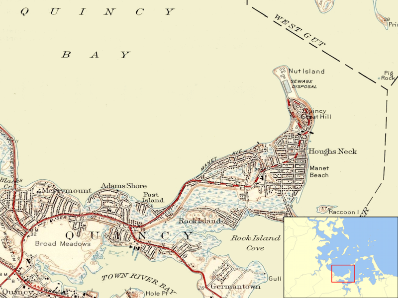
Datei:Nut Island MA 1946.png
aus Wikipedia, der freien Enzyklopädie

Größe dieser Vorschau: 800 × 600 Pixel. Weitere Auflösungen: 320 × 240 Pixel | 640 × 480 Pixel | 1.024 × 768 Pixel | 1.304 × 978 Pixel.
Originaldatei (1.304 × 978 Pixel, Dateigröße: 1,16 MB, MIME-Typ: image/png)
Dateiversionen
Klicke auf einen Zeitpunkt, um diese Version zu laden.
| Version vom | Vorschaubild | Maße | Benutzer | Kommentar | |
|---|---|---|---|---|---|
| aktuell | 06:53, 11. Jun. 2009 |  | 1.304 × 978 (1,16 MB) | wikimediacommons>Sswonk | {{Information |Description={{en|1=Map showing the position of Nut Island on the eastern shore of Quincy Bay with inset showing the location of the mapped area in Boston Harbor.}} |Source=U.S. Geological Survey, obtained from University of New Hampshire co |
Dateiverwendung
Die folgende Seite verwendet diese Datei:
