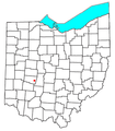
Datei:OHMap-doton-Plattsburgh.png
aus Wikipedia, der freien Enzyklopädie
OHMap-doton-Plattsburgh.png (309 × 352 Pixel, Dateigröße: 17 KB, MIME-Typ: image/png)
Dateiversionen
Klicke auf einen Zeitpunkt, um diese Version zu laden.
| Version vom | Vorschaubild | Maße | Benutzer | Kommentar | |
|---|---|---|---|---|---|
| aktuell | 13:56, 2. Okt. 2007 |  | 309 × 352 (17 KB) | wikimediacommons>Nyttend | {{Information |Description=Locator map of the {{w|unincorporated area|unincorporated community}} of {{w|Plattsburgh, Ohio|Plattsburgh}} in {{w|Clark County, Ohio|Clark County}}, {{w|Ohio}}, {{w|United States}}. |Source=Modified from [http://www2.census.go |
Dateiverwendung
Die folgende Seite verwendet diese Datei:
