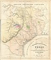
Datei:Roemer Topographisch-Geognostiche Karte von Texas 1849 UTA.jpg
aus Wikipedia, der freien Enzyklopädie

Größe dieser Vorschau: 516 × 599 Pixel. Weitere Auflösungen: 207 × 240 Pixel | 413 × 480 Pixel | 661 × 768 Pixel | 882 × 1.024 Pixel | 1.764 × 2.048 Pixel | 5.826 × 6.764 Pixel.
Originaldatei (5.826 × 6.764 Pixel, Dateigröße: 11,85 MB, MIME-Typ: image/jpeg)
Dateiversionen
Klicke auf einen Zeitpunkt, um diese Version zu laden.
| Version vom | Vorschaubild | Maße | Benutzer | Kommentar | |
|---|---|---|---|---|---|
| aktuell | 17:52, 12. Mär. 2022 |  | 5.826 × 6.764 (11,85 MB) | wikimediacommons>Michael Barera | == {{int:filedesc}} == {{Map |title = {{de|'''''Topographisch-Geognostische Karte von Texas'''''}} |description = {{en|Dr. Ferdinand von Roemer's 1849 map of Texas contains considerable information about trails and roads in Texas in addition to other topographical, geological, and even botanical details. It is based upon ''A New & Correct Map of Texas'' by James T. D. Wilson, published by R. W. Fishbourne in New Orleans in 1845, a map based upon Texas General Land Office s... |
Dateiverwendung
Die folgende Seite verwendet diese Datei:


