Zur Beschreibungsseite auf Commons

Datei:Satellite image of Philippines in March 2002.jpg

aus Wikipedia, der freien Enzyklopädie
Originaldatei(4.600 × 6.000 Pixel, Dateigröße: 3,58 MB, MIME-Typ: image/jpeg)

Commons-logo.svg

Diese Datei und die Informationen unter dem roten Trennstrich werden aus dem zentralen Medienarchiv Wikimedia Commons eingebunden.

Zur Beschreibungsseite auf Commons


Beschreibung

Beschreibung

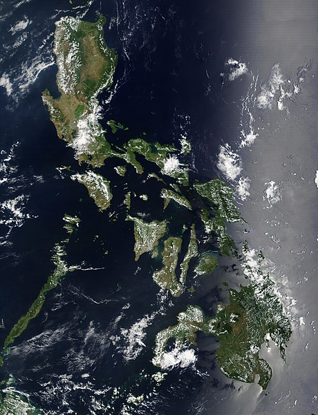
Satellite image of Philippines in March 2002.

Red dots (or outlines in the high-resolution imagery) indicate MODIS9 detection of thermal anomalies throughout the Philippines on March 29, 2002. In most cases, the anomaly is a fire, for example, all the locations marked on the northernmost island, Luzon. However, south of center, on the southern tip of Negros, the thermal anomaly is likely volcanic activity, and the red dot left of center of the main part of Mindanao (lower right) marks the location of a volcano called Mount Ragang.
Datum
Quelle http://visibleearth.nasa.gov/view_rec.php?id=2689
Urheber NASA

Lizenz

Public domain Diese Datei ist gemeinfrei (public domain), da sie von der NASA erstellt worden ist. Die NASA-Urheberrechtsrichtlinie besagt, dass „NASA-Material nicht durch Urheberrecht geschützt ist, wenn es nicht anders angegeben ist“. (NASA-Urheberrechtsrichtlinie-Seite oder JPL Image Use Policy).
Warnung:

Kurzbeschreibungen

Ergänze eine einzeilige Erklärung, was diese Datei darstellt.

In dieser Datei abgebildete Objekte

Motiv

Dateiversionen

Klicke auf einen Zeitpunkt, um diese Version zu laden.

Version vomVorschaubildMaßeBenutzerKommentar
aktuell11:32, 21. Dez. 2004Vorschaubild der Version vom 11:32, 21. Dez. 20044.600 × 6.000 (3,58 MB)wikimediacommons>Hautala{{PD-USGov-NASA}} Satellite image of Philippines in March 2002. Taken from NASA's Visible Earth http://visibleearth.nasa.gov/cgi-bin/viewrecord?12847 . Description: Red dots (or outlines in the high-resolution imagery) indicate MODIS9 detection of thermal

Metadaten