Datei:South Shetland Islands location map.svg
aus Wikipedia, der freien Enzyklopädie

Größe der PNG-Vorschau dieser SVG-Datei: 800 × 453 Pixel. Weitere Auflösungen: 320 × 181 Pixel | 640 × 362 Pixel | 1.024 × 579 Pixel | 1.280 × 724 Pixel | 2.560 × 1.449 Pixel | 1.373 × 777 Pixel.
Originaldatei (SVG-Datei, Basisgröße: 1.373 × 777 Pixel, Dateigröße: 60 KB)
![]()
Diese Datei und die Informationen unter dem roten Trennstrich werden aus dem zentralen Medienarchiv Wikimedia Commons eingebunden.
![]()
Beschreibung
| Beschreibung |
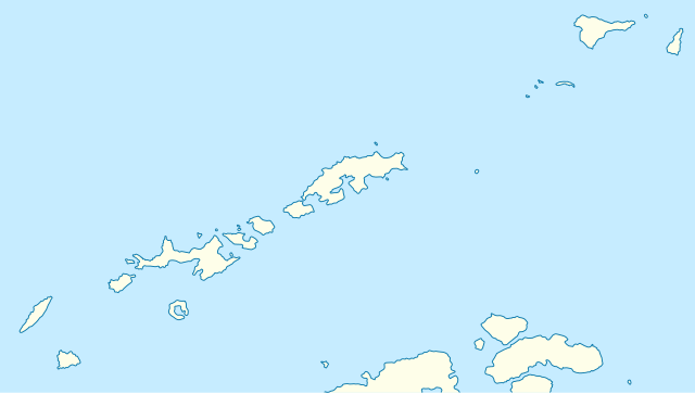
Deutsch: Positionskarte der Südlichen Shetlandinseln
Quadratische Plattkarte, N-S-Streckung 200 %. Geographische Begrenzung der Karte:
English: Location map of the South Shetland Islands
Equirectangular projection, N/S stretching 200 %. Geographic limits of the map:
|
| Datum | |
| Quelle | own work, using United States National Imagery and Mapping Agency data |
| Urheber | NordNordWest |

|
Diese Karte wurde in der Kartenwerkstatt erstellt oder verbessert. Auch du kannst dort Karten vorschlagen, die zu erstellen, verändern oder übersetzen sind.
|
Lizenz
Ich, der Urheberrechtsinhaber dieses Werkes, veröffentliche es hiermit unter der folgenden Lizenz:

|
Es ist erlaubt, die Datei unter den Bedingungen der GNU-Lizenz für freie Dokumentation, Version 1.2 oder einer späteren Version, veröffentlicht von der Free Software Foundation, zu kopieren, zu verbreiten und/oder zu modifizieren; es gibt keine unveränderlichen Abschnitte, keinen vorderen und keinen hinteren Umschlagtext.
Der vollständige Text der Lizenz ist im Kapitel GNU-Lizenz für freie Dokumentation verfügbar. |
Diese Datei ist unter der Creative-Commons-Lizenz „Namensnennung – Weitergabe unter gleichen Bedingungen 3.0 nicht portiert“ lizenziert.
- Dieses Werk darf von dir
- verbreitet werden – vervielfältigt, verbreitet und öffentlich zugänglich gemacht werden
- neu zusammengestellt werden – abgewandelt und bearbeitet werden
- Zu den folgenden Bedingungen:
- Namensnennung – Du musst angemessene Urheber- und Rechteangaben machen, einen Link zur Lizenz beifügen und angeben, ob Änderungen vorgenommen wurden. Diese Angaben dürfen in jeder angemessenen Art und Weise gemacht werden, allerdings nicht so, dass der Eindruck entsteht, der Lizenzgeber unterstütze gerade dich oder deine Nutzung besonders.
- Weitergabe unter gleichen Bedingungen – Wenn du das Material wiedermischst, transformierst oder darauf aufbaust, musst du deine Beiträge unter der gleichen oder einer kompatiblen Lizenz wie das Original verbreiten.
Du darfst es unter einer der obigen Lizenzen deiner Wahl verwenden.
Dateiversionen
Klicke auf einen Zeitpunkt, um diese Version zu laden.
| Version vom | Vorschaubild | Maße | Benutzer | Kommentar | |
|---|---|---|---|---|---|
| aktuell | 07:52, 31. Mär. 2009 | | 1.373 × 777 (60 KB) | wikimediacommons>NordNordWest | corr |
Dateiverwendung
Mehr als 100 Seiten verwenden diese Datei. Die folgende Liste zeigt nur die ersten 100 Verwendungen dieser Datei. Eine vollständige Liste ist verfügbar.
- Admiralen Peak
- Admiralty Bay
- Aim Rocks
- Aitcho-Inseln
- Ajax-Eisfall
- Ajmonecatsee
- Aleko Rock
- Anna-Gletscher
- Anvil Crag
- Arctowski-Bucht
- Arctowski Dome
- Ardley Cove
- Ardley Island
- Argentinien-Bucht
- Argentinien-Gletscher
- Ash Point
- Aspis Island
- Baranowski-Gletscher
- Barnard Point
- Belweder
- Bridgeman Island
- Cape Lookout (Elephant Island)
- Carlini-Station
- Clarence Island
- Cornwallis-Insel (Südliche Shetlandinseln)
- Crépin Point
- Deacon Peak
- Deception Island
- Dee Island
- Demay Point
- Discovery Bay (Südliche Shetlandinseln)
- Dunbar-Inseln
- Elephant Island
- Elephant Point
- English Strait
- Ezcurra-Fjord
- False Bay (Livingston-Insel)
- Fildes-Halbinsel
- Fildes Strait
- Gibbs Island
- Greenwich Island
- Half Moon Island
- Henry Bluff
- Hurd-Halbinsel
- Hurd Dome
- Johnsons Dock
- Kap Melville
- Kap Timblón
- King George Bay (Südliche Shetlandinseln)
- King George Island
- Laguna Hill
- Legru Bay
- Lions Rump
- Livingston-Insel
- Long Rock (Südliche Shetlandinseln)
- Low Island (Südliche Shetlandinseln)
- Mackellar Inlet
- Martel Inlet
- Martins Head
- Maxwell Bay
- Miers Bluff
- Morton Strait
- Mount Achala
- Mount Foster
- Mount Friesland
- Mount Hopeful
- Mount Irving
- Nelson Island (Südliche Shetlandinseln)
- North Foreland (King George Island)
- Ongley Island
- Penguin Island (Südliche Shetlandinseln)
- Point Thomas
- Polish Bluff
- Polonia-Piedmont-Gletscher
- Port Foster
- Rea Peak
- Robert Island (Südliche Shetlandinseln)
- Rose Peak
- Rowett Island
- Rugged Island (Südliche Shetlandinseln)
- Sherratt Bay
- Smith Island (Südliche Shetlandinseln)
- Snow Island (Südliche Shetlandinseln)
- South Bay (Livingston-Insel)
- Spanish Point
- Sphinx Hill
- Stancomb Cove
- Stenhouse Bluff
- Table Island (Südliche Shetlandinseln)
- Telefon Bay
- Telefon Point
- Telefon Ridge
- Telefon Rocks
- Telerig-Nunatak
- Ternyck Needle
- Turret Point
- Ullmann Spur
- Visca Anchorage
- Wörner Gap
- Wikiup:Kartenwerkstatt/Archiv/2009-03
Weitere Links auf diese Datei.
