Datei:Zarit incident map.png
aus Wikipedia, der freien Enzyklopädie

Es ist keine höhere Auflösung vorhanden.
Zarit_incident_map.png (519 × 298 Pixel, Dateigröße: 67 KB, MIME-Typ: image/png)
![]()
Diese Datei und die Informationen unter dem roten Trennstrich werden aus dem zentralen Medienarchiv Wikimedia Commons eingebunden.
![]()
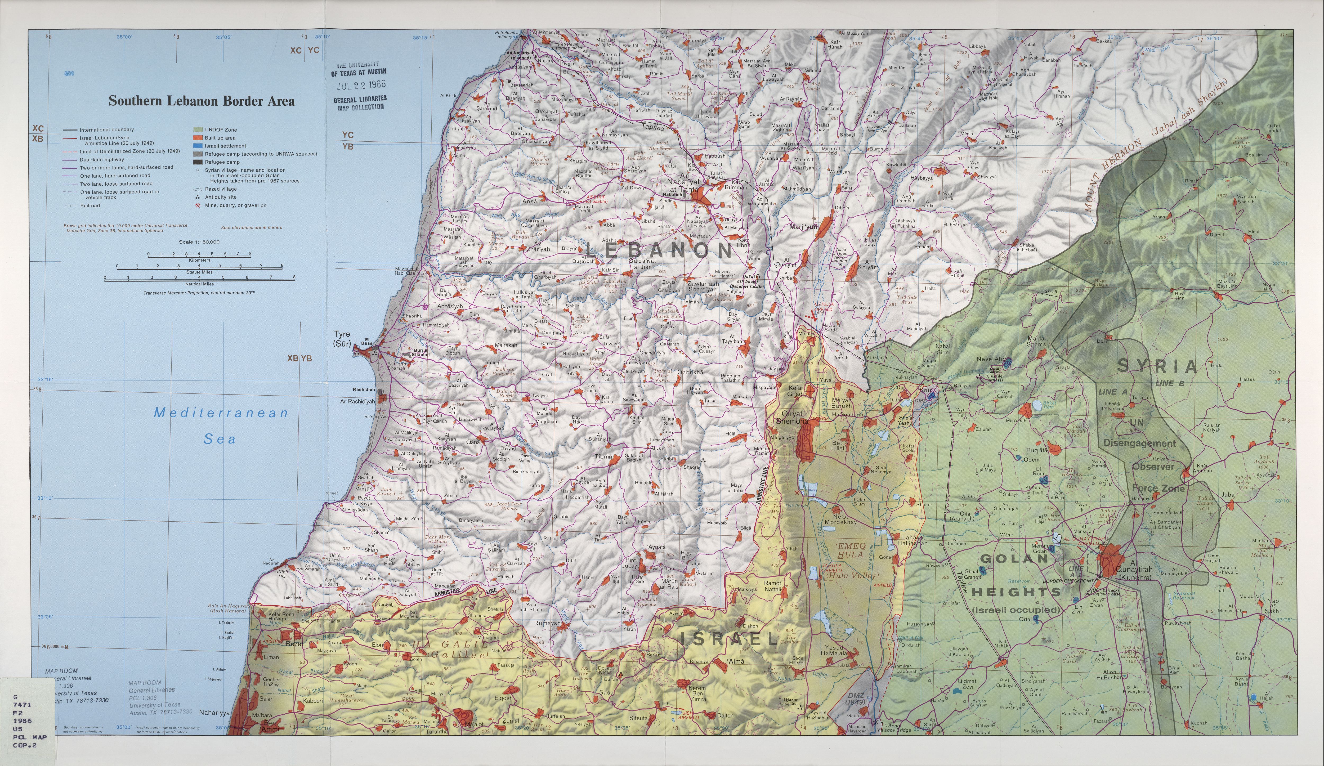
| Beschreibung | Map of Zar'it and vicinity illustrating the localities involved in the Zar'it-Ayta ash-Shab incident which sparked the 2006 Israel-Lebanon conflict. |
| Datum | Incident happened on July 12 2006. Upload August 17 2006. |
| Quelle | Uploaded as en:Image:Zarit incident map.png. Based on http://www.lib.utexas.edu/maps/middle_east_and_asia/lebanon_southern_border_1986.jpg |
| Urheber | Original map is the work of the Central Intelligence Agency. Modifications by en:User:ChrisO. |
| Genehmigung (Weiternutzung dieser Datei) |
PD |
| Dieses Bild ist eine Arbeit eines CIA-Mitarbeiters. Als ein Werk der Regierung der Vereinigten Staaten ist dieses Bild in den USA gemeinfrei.
|

|
Dateiversionen
Klicke auf einen Zeitpunkt, um diese Version zu laden.
| Version vom | Vorschaubild | Maße | Benutzer | Kommentar | |
|---|---|---|---|---|---|
| aktuell | 23:58, 19. Aug. 2006 | | 519 × 298 (67 KB) | wikimediacommons>Jkelly | {{Information |Description=Map of Zar'it and vicinity illustrating the localities involved in the Zar'it-Ayta ash-Shab incident which sparked the 2006 Israel-Lebanon conflict. |Source=Uploaded as en:Image:Zarit incident map.png. Based on htt |
Dateiverwendung
Die folgenden 3 Seiten verwenden diese Datei:
