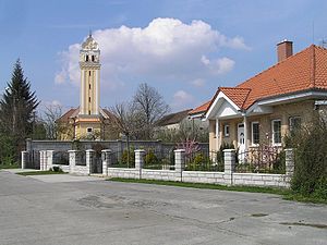
Horná Streda
aus Wikipedia, der freien Enzyklopädie
| Horná Streda | ||
|---|---|---|
| Wappen | Karte | |
| Wappen von Horná Streda | ||
| Basisdaten | ||
| Staat: | ||
| Kraj: | Trenčiansky kraj | |
| Okres: | Nové Mesto nad Váhom | |
| Region: | Stredné Považie | |
| Fläche: | 9,827 km² | |
| Einwohner: | 1.394 (31. Dez. 2020) | |
| Bevölkerungsdichte: | 142 Einwohner je km² | |
| Höhe: | 169 m n.m. | |
| Postleitzahl: | 916 24 | |
| Telefonvorwahl: | 0 32 | |
| Geographische Lage: | 48° 39′ N, 17° 51′ O | |
| Kfz-Kennzeichen: | NM | |
| Kód obce: | 506001 | |
| Struktur | ||
| Gemeindeart: | Gemeinde | |
| Verwaltung (Stand: November 2018) | ||
| Bürgermeister: | Ľubomír Krajňanský | |
| Adresse: | Obecný úrad Horná Streda 407 91624 Horná Streda | |
| Webpräsenz: | www.hornastreda.sk | |
| Statistikinformation auf statistics.sk | ||
Horná Streda (bis 1927 slowakisch „Streda“, bis 1948 „Horná Streda nad Váhom“; ungarisch Felsőszerdahely – bis 1907 Vágszerdahely) ist eine Gemeinde in der Westslowakei. Sie liegt im nördlichen Donauhügelland am Fluss Waag, 8 km von Piešťany und 13 km von Nové Mesto nad Váhom entfernt.
Der Ort wurde 1263 erstmals schriftlich erwähnt.
Er besitzt eine Haltestelle an der Bahnstrecke Bratislava–Žilina sowie eine Ausfahrt der Autobahn D1.
Weblinks
Commons: Horná Streda – Sammlung von Bildern, Videos und Audiodateien

