Jessadi
| Jessadi | ||
|---|---|---|
| Koordinaten: 13° 38′ N, 15° 18′ W | ||
| Region: | Central River | |
| Distrikt: | Niamina Dankunku | |
| Einwohner: | 434 (2013)
| |
| <timeline>
ImageSize = width:240 height:140 PlotArea = left:50 bottom:20 width:190 height:120 TimeAxis = orientation:horizontal AlignBars = early Colors = id:hellgrau value:gray(0.9) id:graygrid value:gray(0.5) id:farbe value:drabgreen DateFormat = yyyy Period = from:1961 till:2028 ScaleMajor = unit:year increment:15 start:1965
 bar:15 text:""


 bar:2 text:500
 bar:1 text:250
PlotData = color:hellgrau width:0.1 Bar:15 from:start till:end Bar:2 from:start till:end Bar:1 from:start till:end LineData = layer:front frompos:21 color:farbe width:1 at:1993 tillpos:96.52 at:2010 tillpos:96.04 at:2011 tillpos:95.24 at:2012 tillpos:94.6 at:2013 tillpos:90.44 TextData = pos:(0,28) tabs:(46-right) text:"^0" pos:(0,140) tabs:(50-right) text:"^Einwohner" </timeline> | ||
Jessadi (Namensvariante: Kulenia) ist eine Ortschaft im westafrikanischen Staat Gambia.
Nach einer Berechnung für das Jahr 2013 leben dort etwa 434 Einwohner, das Ergebnis der letzten veröffentlichten Volkszählung von 1993 betrug 472.[1]
Geographie
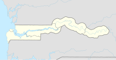
Jessadi, in der Central River Region im Distrikt Niamina Dankunku, liegt am südlichen Ufer des Gambia-Flusses. Der Ort liegt rund 1,5 Kilometer östlich von Baro Kunda.
Jessadi Wharf Town befindet sich unmittelbar am Ufer des Flusses, 2,75 Kilometer nordöstlich des Orts.
Siehe auch
Einzelnachweise
- ↑ Jessadi auf bevoelkerungsstatistik.de (online nicht mehr erreichbar, letzter Zugriff Mai 2013)
