Jiroff
aus Wikipedia, der freien Enzyklopädie
| Jiroff | ||
|---|---|---|
| Koordinaten: 13° 26′ N, 15° 42′ W | ||
| Region: | Lower River | |
| Distrikt: | Kiang Central | |
| Einwohner: | 622 (2013)
| |
| <timeline>
ImageSize = width:240 height:140 PlotArea = left:50 bottom:20 width:190 height:120 TimeAxis = orientation:horizontal AlignBars = early Colors = id:hellgrau value:gray(0.9) id:graygrid value:gray(0.5) id:farbe value:drabgreen DateFormat = yyyy Period = from:1961 till:2028 ScaleMajor = unit:year increment:15 start:1965
 bar:15 text:""


 bar:2 text:500
 bar:1 text:250
PlotData = color:hellgrau width:0.1 Bar:15 from:start till:end Bar:2 from:start till:end Bar:1 from:start till:end LineData = layer:front frompos:21 color:farbe width:1 at:1993 tillpos:110.92 at:2010 tillpos:125.16 at:2011 tillpos:125.16 at:2012 tillpos:125.16 at:2013 tillpos:120.52 TextData = pos:(0,28) tabs:(46-right) text:"^0" pos:(0,140) tabs:(50-right) text:"^Einwohner" </timeline> | ||
Jiroff ist eine Ortschaft im westafrikanischen Staat Gambia.
Nach einer Berechnung für das Jahr 2013 leben dort etwa 622 Einwohner, das Ergebnis der letzten veröffentlichten Volkszählung von 1993 betrug 562.[1]
Geographie
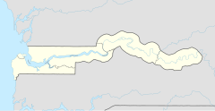
Jiroff liegt in der Lower River Region im Distrikt Kiang Central. Der Ort liegt rund 0,5 Kilometer nördlich der South Bank Road, Gambias wichtigster Fernstraße, zwischen Kunong Maria und Nema Kuta.
Siehe auch
Einzelnachweise
- ↑ Jiroff auf bevoelkerungsstatistik.de (online nicht mehr erreichbar, letzter Zugriff Mai 2013)
