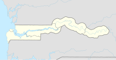
Karantaba (Central River Region)
| Karantaba | ||
|---|---|---|
| Koordinaten: 13° 34′ N, 14° 34′ W | ||
| Region: | Central River | |
| Distrikt: | Sami | |
| Einwohner: | 1907 (2013)
| |
| <timeline>
ImageSize = width:240 height:140 PlotArea = left:50 bottom:20 width:190 height:120 TimeAxis = orientation:horizontal AlignBars = early Colors = id:hellgrau value:gray(0.9) id:graygrid value:gray(0.5) id:farbe value:drabgreen DateFormat = yyyy Period = from:1961 till:2028 ScaleMajor = unit:year increment:15 start:1965
 bar:15 text:""


 bar:4 text:2000
 bar:3 text:1500
 bar:2 text:1000
 bar:1 text:500
PlotData = color:hellgrau width:0.1 Bar:15 from:start till:end Bar:4 from:start till:end Bar:3 from:start till:end Bar:2 from:start till:end Bar:1 from:start till:end LineData = layer:front frompos:21 color:farbe width:1 at:1993 tillpos:89.976 at:2006 tillpos:106.056 at:2007 tillpos:106.968 at:2008 tillpos:112.392 at:2009 tillpos:113.256 at:2010 tillpos:114.072 at:2012 tillpos:115.656 at:2013 tillpos:112.536 TextData = pos:(0,28) tabs:(46-right) text:"^0" pos:(0,140) tabs:(50-right) text:"^Einwohner" </timeline> | ||
Karantaba und Karantaba Tenda (früherer Name: Pisania) ist eine Ortschaft mit historischer Bedeutung im westafrikanischen Staat Gambia.
Nach einer Berechnung für das Jahr 2013 leben dort etwa 1907 Einwohner, das Ergebnis der letzten veröffentlichten Volkszählung von 1993 betrug 1437.[1]
Geographie
Karantaba Tenda liegt in der Central River Region im Distrikt Sami auf einer Höhe von 11 m und ist ungefähr dreizehn Kilometer östlich von Janjanbureh entfernt. Der Ort liegt rund 1,7 Kilometer vom Ufer des Gambia-Flusses entfernt.
Die Anlegestelle am Ufer wird Karantaba Tenda genannt (13° 34′ N, 14° 34′ W).
Geschichte
Der Afrikaforscher Mungo Park hielt sich hier in Pisania, wie der Ort früher genannt wurde, 1795 einige Zeit auf, bevor er zu seiner Reise ins Innere des Kontinents nach Osten zum Niger aufbrach. Er verbrachte ab Juli fünf Monate bei der britischen Faktorei, beim Sklavenhändler Dr. Laidley, um sich zu akklimatisieren und die Mandinka-Sprache zu erlernen.
Kultur und Sehenswürdigkeiten
Heute erinnert das Mungo Park Memorial bei Karantaba Tenda an den Beginn seiner Reise. Der auf einem Sockel stehende schlichte Zement-Obelisk wurde 1930 zum Gedenken an den Forscher aufgestellt.[2]
Söhne und Töchter des Ortes
- Hassan Sallah (1948–2006), Politiker
Siehe auch
Einzelnachweise
- ↑ Karantaba (Central River Region) auf bevoelkerungsstatistik.de (online nicht mehr erreichbar, letzter Zugriff Mai 2013)
- ↑ Allen Meagher (Hrsg.): Historic sites of The Gambia. Ada Dinkiralu (Mandinka), Bereb-I-Chosan (Wolof), Tarica Tawal (Fula), Nannin (Jola), Soninke Ada (Serehuli), I-Mofan Chosan (Serer). An official guide to the monuments and sites of The Gambia. National Council for the Arts and Culture, Banjul The Gambia 1998, ISBN 9983-80-011-014
