Kerewan
| Kerewan | ||
|---|---|---|
| Koordinaten: 13° 30′ N, 16° 5′ W | ||
| Region: | North Bank | |
| Distrikt: | Lower Baddibu | |
| Einwohner: | 3534 (2013)
| |
| <timeline>
ImageSize = width:240 height:153.33333333333 PlotArea = left:50 bottom:20 width:190 height:133.33333333333 TimeAxis = orientation:horizontal AlignBars = early Colors = id:hellgrau value:gray(0.9) id:graygrid value:gray(0.5) id:farbe value:drabgreen DateFormat = yyyy Period = from:1961 till:2028 ScaleMajor = unit:year increment:15 start:1965
 bar:15 text:""


 bar:4 text:4000
 bar:3 text:3000
 bar:2 text:2000
 bar:1 text:1000
PlotData = color:hellgrau width:0.1 Bar:15 from:start till:end Bar:4 from:start till:end Bar:3 from:start till:end Bar:2 from:start till:end Bar:1 from:start till:end LineData = layer:front frompos:21 color:farbe width:1 at:1983 tillpos:105.61333333333 at:1993 tillpos:111.74666666667 at:2005 tillpos:94.36 at:2006 tillpos:92.786666666667 at:2007 tillpos:91.213333333333 at:2009 tillpos:98.04 at:2010 tillpos:114.62666666667 at:2012 tillpos:112.76 at:2013 tillpos:115.24 TextData = pos:(0,28) tabs:(46-right) text:"^0" pos:(0,153.33333333333) tabs:(50-right) text:"^Einwohner" </timeline> | ||
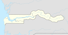
Kerewan (Schreibvariante: Kerevane) ist eine Ortschaft im westafrikanischen Staat Gambia und ist bis 2010 Sitz der Verwaltungseinheit North Bank Region.
Nach einer Berechnung für das Jahr 2013 leben dort etwa 3534 Einwohner, das Ergebnis der letzten veröffentlichten Volkszählung von 1993 betrug 3403.[1]
Geographie
Kerewan, früher Sitz der Verwaltungseinheit North Bank Region und liegt im Distrikt Lower Baddibu, liegt am nördlichen Ufer des Gambia, an einem Seitenarm mit dem Namen Mini Miniyang Bolong (nach anderen Quellen Jowara Bolong bzw. Koular Bolong in Senegal) und ungefähr 50 Kilometer östlich von der Hauptstadt Banjul und 50 Kilometer westlich von Farafenni entfernt. Die typische Landschaft ist Sumpf und weiter vom Fluss entfernt die Savanne. Die North Bank Road die nach Farafenni führt und damit die North Bank Region durchquert, ist nicht asphaltiert, sie soll aber bis im Jahr 2007 ausgebaut werden.
Siehe auch
Einzelnachweise
- ↑ Kerewan auf bevoelkerungsstatistik.de (online nicht mehr erreichbar, letzter Zugriff Mai 2013)
