Koni Ngani
| Koni Ngani | ||
|---|---|---|
|
| ||
| Koordinaten | 12° 13′ S, 44° 29′ O | |
| Basisdaten | ||
| Staat | Komoren | |
| Präfektur | Domoni | |
| ISO 3166-2 | KM | |
| Gemeinde | Koni | |
| Höhe | 704 m | |
| Einwohner | 3913 (18. Januar 2012) | |
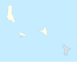
Koni Ngani ist ein Dorf auf der Komoreninsel Anjouan im Indischen Ozean. Die Stadt befindet sich an einem Gebirgszug auf einer Höhe von ca. 700 m.[1]
Bevölkerung
<graph>{ "version": 2, "width": 200, "height": 200, "data": [ { "name": "table", "values": [ { "x": 1991, "y": 2045 }, { "x": 2012, "y": 3913 } ] } ], "scales": [ { "name": "x", "type": "ordinal", "range": "width", "zero": false, "domain": { "data": "table", "field": "x" } }, { "name": "y", "type": "linear", "range": "height", "nice": true, "domain": { "data": "table", "field": "y" } } ], "axes": [ { "type": "x", "scale": "x" }, { "type": "y", "scale": "y" } ], "marks": [ { "type": "rect", "from": { "data": "table" }, "properties": { "enter": { "x": { "scale": "x", "field": "x" }, "y": { "scale": "y", "field": "y" }, "y2": { "scale": "y", "value": 0 }, "fill": { "value": "steelblue" }, "width": { "scale": "x", "band": "true", "offset": -1 } } } } ] }</graph>
Geografie
Koni Djodjo liegt im Zentrum der Insel. Ca. 10 km nordwestlich der Stadt befindet sich die Inselhauptstadt Mutsamudu, mit der Koni Djodjo über eine Straße verbunden ist. Die Fahrtstrecke beträgt allerdings rund 32 km.[2] Die nächstgrößere Stadt ist Domoni. Sie befindet sich ca. 7 km südöstlich der Stadt.[3] Der Flughafen der Insel in Ouani liegt 11 km in nordwestlicher Richtung.[4]
Einzelnachweise
- ↑ Google Maps GPS Koordinaten, Breiten- und Längengrad. Abgerufen am 29. September 2017.
- ↑ Entfernung Koni-Ngani, Anjouan, COM > Mutsamudu, Anjouan, COM - Luftlinie, Fahrstrecke, Mittelpunkt. Abgerufen am 29. September 2017 (deutsch).
- ↑ Entfernung Koni-Ngani, Anjouan, COM > Domoni, Anjouan, COM - Luftlinie, Fahrstrecke, Mittelpunkt. Abgerufen am 29. September 2017 (deutsch).
- ↑ Entfernung Koni-Ngani, Anjouan, COM > Ouani, Anjouan, COM - Luftlinie, Fahrstrecke, Mittelpunkt. Abgerufen am 29. September 2017 (deutsch).
