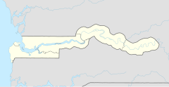
Nema Kunku
| Nema Kunku | ||
|---|---|---|
| Koordinaten: 13° 24′ N, 16° 41′ W | ||
| Region: | West Coast | |
| Distrikt: | Kombo North | |
| Einwohner: | 36.134 (2013)
| |
| <timeline>
ImageSize = width:240 height:140 PlotArea = left:50 bottom:20 width:190 height:120 TimeAxis = orientation:horizontal AlignBars = early Colors = id:hellgrau value:gray(0.9) id:graygrid value:gray(0.5) id:farbe value:drabgreen DateFormat = yyyy Period = from:1961 till:2028 ScaleMajor = unit:year increment:15 start:1965
 bar:15 text:""


 bar:4 text:40000
 bar:3 text:30000
 bar:2 text:20000
 bar:1 text:10000
PlotData = color:hellgrau width:0.1 Bar:15 from:start till:end Bar:4 from:start till:end Bar:3 from:start till:end Bar:2 from:start till:end Bar:1 from:start till:end LineData = layer:front frompos:21 color:farbe width:1 at:1983 tillpos:23.8992 at:1993 tillpos:44.6112 at:2006 tillpos:79.1808 at:2007 tillpos:82.6584 at:2008 tillpos:89.9064 at:2009 tillpos:93.996 at:2010 tillpos:98.3112 at:2012 tillpos:107.5656 at:2013 tillpos:107.7216 TextData = pos:(0,28) tabs:(46-right) text:"^0" pos:(0,140) tabs:(50-right) text:"^Einwohner" </timeline> | ||
Nema Kunku (Namensvariante: Sare Mawndeh [alter Name]) ist eine Ortschaft im westafrikanischen Staat Gambia.
Nach einer Berechnung für das Jahr 2013 leben dort etwa 36.134 Einwohner, das Ergebnis der letzten veröffentlichten Volkszählung von 1993 betrug 1208.[1]
Geographie
Der Ort befindet sich südlich des Flusses Gambia. Nema Kunku befindet sich in der West Coast Region, Distrikt Kombo North, und liegt westlich von Wellingara an der Straße nach Sukuta. Sie liegt damit am südlichen Rand der Kombo-St. Mary Area.
Bauwerke und Infrastruktur
Im Februar 2020 wurde durch den Brikama Area Council (BAC) die neu errichtete Markthalle zur Nutzung frei gegeben. Die Anlage hat eine Kapazität um mehr als 100 Verkäufer aufzunehmen.[2]
Siehe auch
Weblinks
- Straßen-Karte der Umgebung (Memento vom 29. September 2007 im Internet Archive)
Einzelnachweise
- ↑ Nema Kunku auf bevoelkerungsstatistik.de (online nicht mehr erreichbar, letzter Zugriff Mai 2013)
- ↑ BAC inaugurates new Nema Kunku Market. In: thepoint.gm. 24. Februar 2020, abgerufen am 24. Februar 2020.
