Ponta da Mina
aus Wikipedia, der freien Enzyklopädie
| Ponta da Mina | ||
|---|---|---|
|
| ||
| Koordinaten | 1° 39′ N, 7° 26′ O | |
| Basisdaten | ||
| Staat | São Tomé und Príncipe | |
| Príncipe | ||
| ISO 3166-2 | ST-P | |
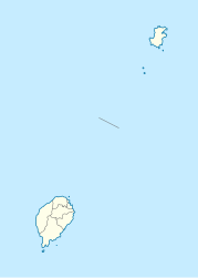
Ponta da Mina (portug. für „Spitze des Bergwerks“) ist eine Landzunge 2 km nordöstlich von Santo António, der Inselhauptstadt der Insel Príncipe in São Tomé und Príncipe.
Geographie
Die Landzunge erstreckt sich von Süden in die Baía de Santo António. Sie wird von Felsen gerahmt und die Festung Fortaleza de Santo António da Ponta da Mina befindet sich auf ihrem höchsten Punkt. Die nächste Siedlung ist São João im Westen. Nach Südosten erstreckt sich der Strand Praia de Évora[1]
In der Nähe der Festung steht ein Leuchtturm, der erst 1996 errichtet wurde.[2] Das Leuchtfeuer ist 54 m hoch und reicht bis zu 9 NM (17 km) weit.[3]
Einzelnachweise
- ↑ geonames.org.
- ↑ Russ Rowlett: Lighthouses of São Tomé and Príncipe. The Lighthouse Directory. University of North Carolina at Chapel Hill.
- ↑ List of Lights, Pub. 113: The West Coasts of Europe and Africa, the Mediterranean Sea, Black Sea and Azovskoye More (Sea of Azov) (PDF). List of Lights. United States National Geospatial-Intelligence Agency. 2018: 441.
