Shady Oak Lake
aus Wikipedia, der freien Enzyklopädie
| Shady Oak Lake | ||
|---|---|---|
| Geographische Lage | Minnetonka, Hennepin County, Minnesota, USA | |
| Zuflüsse | keine | |
| Abfluss | keiner | |
| Daten | ||
| Koordinaten | 44° 54′ 38,48″ N, 93° 25′ 53,53″ W | |
|
| ||
| Höhe über Meeresspiegel | 276 m | |
| Fläche | 53 ha | |
| Maximale Tiefe | 10,7 m | |
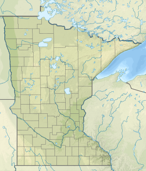
Der Shady Oak Lake (auch als Shady Lake bezeichnet[1]) ist ein See in Minnetonka im Hennepin County im US-Bundesstaat Minnesota. Er befindet sich im Osten der Stadt an der Shady Oak Road beziehungsweise 500 Meter östlich des Interstate 494. Die Fläche des Sees mit dem Litoral beträgt 53 Hektar. Die maximale Tiefe beträgt 10,7 Meter.[2][3]
Fischbestand
Im Rahmen einer Fischbestandsaufnahme des Shady Oak Lake von 1991 wurde das Vorhandensein folgender Fischarten festgestellt:[3]
- Barschartige:
- Blauer Sonnenbarsch (Lepomis macrochirus)
- Gemeiner Sonnenbarsch (Lepomis gibbosus)
- Forellenbarsch (Micropterus salmoides)
- Schwarzflecken-Sonnenbarsch (Pomoxis nigromaculatus)
- Diverse Barschhybride
- Hechtartige:
- Hecht (Esox lucius)
- Karpfenartige:
- Karpfen (Cyprinus carpio)
- Welsartige:
- Gelber Katzenwels (Ameiurus natalis)
- Katzenwels (Ameiurus nebulosus)
- Schwarzer Zwergwels (Ameiurus melas)
Weblinks
Einzelnachweise
- ↑ U.S. Geological Survey. Geographic Names Phase I data compilation (1976-1981). 31-Dec-1981. Primarily from U.S. Geological Survey 1:24,000-scale topographic maps (or 1:25K, Puerto Rico 1:20K) and from U.S. Board on Geographic Names files. In some instances, from 1:62,500 scale or 1:250,000 scale maps
- ↑ Shady Oak Lake im Geographic Names Information System des United States Geological Survey
- ↑ a b Lake information report: Minnesota DNR
