Wayne County (Pennsylvania)
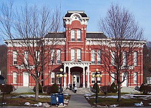
 Wayne County Courthouse | |
| Verwaltung | |
|---|---|
| US-Bundesstaat: | Pennsylvania |
| Verwaltungssitz: | Honesdale |
| Adresse des Verwaltungssitzes: |
Wayne County Courthouse 925 Court Street Honesdale PA 18431 |
| Gründung: | 21. März 1798 |
| Gebildet aus: | Northampton County |
| Vorwahl: | 001 570 |
| Demographie | |
| Einwohner: | (Stand: ) |
| Geographie | |
| Fläche gesamt: | 1944 km² |
| Wasserfläche: | 55 km² |
| Karte | |
| Website: www.co.wayne.pa.us | |
Wayne County[1] ist ein County im Bundesstaat Pennsylvania der Vereinigten Staaten. Bei der Volkszählung im Jahr 2020 hatte das County 51.155 Einwohner und eine Bevölkerungsdichte von 27 Einwohnern pro Quadratkilometer.[2] Der Verwaltungssitz (County Seat) ist Honesdale.
Geschichte
Das County wurde am 21. März 1798 aus Northampton County gebildet und nach dem General und Politiker Anthony Wayne benannt.[3]
Ein Ort im County hat den Status einer National Historic Landmark, der Delaware and Hudson Canal.[4] 17 Bauwerke und Stätten des Countys sind im National Register of Historic Places (NRHP) eingetragen (Stand 25. Juli 2018).[5]
Geographie
Das County hat eine Fläche von 1944 Quadratkilometern, wovon 55 Quadratkilometer Wasserfläche sind.
Bevölkerungsentwicklung
| Bevölkerungsentwicklung | |||
|---|---|---|---|
| Census | Einwohner | ± rel. | |
| 1900 | 30.171 | — | |
| 1910 | 29.236 | −3,1 % | |
| 1920 | 27.435 | −6,2 % | |
| 1930 | 28.420 | 3,6 % | |
| 1940 | 29.934 | 5,3 % | |
| 1950 | 28.478 | −4,9 % | |
| 1960 | 28.237 | −0,8 % | |
| 1970 | 29.581 | 4,8 % | |
| 1980 | 35.237 | 19,1 % | |
| 1990 | 39.944 | 13,4 % | |
| 2000 | 47.718 | 19,5 % | |
| 2010 | 52.822 | 10,7 % | |
| 2020 | 51.155 | −3,2 % | |
| 1900–1990[6]
2000[7] | |||
Städte und Ortschaften
Weblinks
Einzelnachweise
- ↑ Wayne County im Geographic Names Information System des United States Geological Survey. Abgerufen am 22. Februar 2011
- ↑ U.S. Census Bureau QuickFacts: Wayne County, Pennsylvania. Abgerufen am 28. August 2021 (englisch).
- ↑ Charles Curry Aiken, Joseph Nathan Kane: The American Counties: Origins of County Names, Dates of Creation, Area, and Population Data, 1950–2010. 6. Auflage. Scarecrow Press, Lanham 2013, ISBN 978-0-8108-8762-6, S. 323.
- ↑ Listing of National Historic Landmarks by State: Pennsylvania. National Park Service, abgerufen am 25. Juli 2018.
- ↑ Suchmaske Datenbank im National Register Information System. National Park Service, abgerufen am 25. Juli 2018.
- ↑ Auszug aus Census.gov. Abgerufen am 28. Februar 2011
- ↑ Auszug aus factfinder.census.gov Abgerufen am 28. Februar 2011
Koordinaten: 41° 39′ N, 75° 19′ W